AapdaDRISHTI draws on three decades of EduCARE India field practice in Kangra and adjoining districts, the in-house GIS / HAM radio lab at EDMRC Kangra campus, and a deployable assessment workforce trained through the HimNIRMANAC programme. Our methodology is aligned with the Sendai Framework, PDNA, NDMA and NIDM technical guidelines.
Six core service lines
Multi-Hazard Risk Assessment (HVCA)
Hazard, Vulnerability and Capacity Assessment at village, panchayat and institutional-campus scale. Combines secondary-data review, terrain and exposure analysis, and household-level field documentation through trained CRP / Aapda Mitra cadre.
Building Vulnerability Assessment & Rapid Visual Screening
Field RVS of building stock using NDMA / IIT-derived methodology, delivered through the HimNIRMANAC NirmanNAYAK workforce. The same surveyor cadre that builds safer in routine times becomes the rapid damage-assessment surge capacity in post-event conditions.
Post-Disaster Damage & Loss Assessment (D&L)
Sectoral damage assessment, household-level loss documentation, and recovery-needs identification following a trigger event. Outputs designed to interface with DDMA / SDMA reporting formats and UN Country Team frameworks.
Village & Institutional DM Plan Studies
Village Disaster Management Plan (VDMP) and Institutional Disaster Management Plan (IDMP) preparation per NIDM technical guidelines, with full stakeholder consultation and inter-agency convergence built in.
GIS Hazard Mapping, Terrestrial Survey & Spatial Analysis
Block- and panchayat-level hazard mapping, exposure analysis and risk visualisation. Terrestrial total-station survey for high-precision building footprint, retrofit scoping and damage-volume measurement. Garmin eTrex 10 handheld GNSS units for distributed field waypoint logging.
Drone / UAV-Based Visual Assessment
DJI Mini 4 Pro UAV operational now (sub-250g nano category — no DGCA Yellow Zone permission burden), enabling rapid post-event reconnaissance, oblique imagery and basic photogrammetry with ground control points using Agisoft Metashape. DJI Matrice 4 Enterprise / IdeaForge-class system under procurement for FY 2026–27.
Track record
- Naddi VDMP (2015–16). First village disaster management plan in Kangra District based on NIDM guidelines; foundational template for subsequent panchayat work.
- 40+ Disaster Management Plans Delivered. Across colleges and institutions in Kangra and Hamirpur districts, with select temple complexes and institutional/office settings.
- AapdaPAR Foundation Training (2020–2025). Delivered across all panchayats of Kangra District; currently moving into panchayat- and cluster-level institutionalisation phase.
- DDMA Kangra Partnership. Ongoing Training of Masons, Carpenters & Bar-Binders on Hazard-Resistant Construction, organised in partnership with the District Disaster Management Authority Kangra.
- UNDP — DDMA Kangra Placement. First external graduate of EDMRC's One-Year Certificate in Disaster Management (focus: Landslide Management and Building Vulnerability Assessment) currently placed at DDMA Kangra under UNDP.
- D-IAG Kangra Campaign 2026. "A Year of Volunteer Action for Resilient Kangra" co-launched with DDMA Kangra on International Volunteer Day, 5 December 2025, under the District Inter-Agency Group.
Methodology alignment
All AapdaDRISHTI assessment work is aligned with international and national disaster-management frameworks: Sendai Framework for Disaster Risk Reduction 2015–2030, PDNA (Post-Disaster Needs Assessment), the NDMA National Disaster Management Plan, NIDM technical guidelines, the HP State Disaster Management Plan, and Sphere Standards for humanitarian assessment.
Assessment work in progress
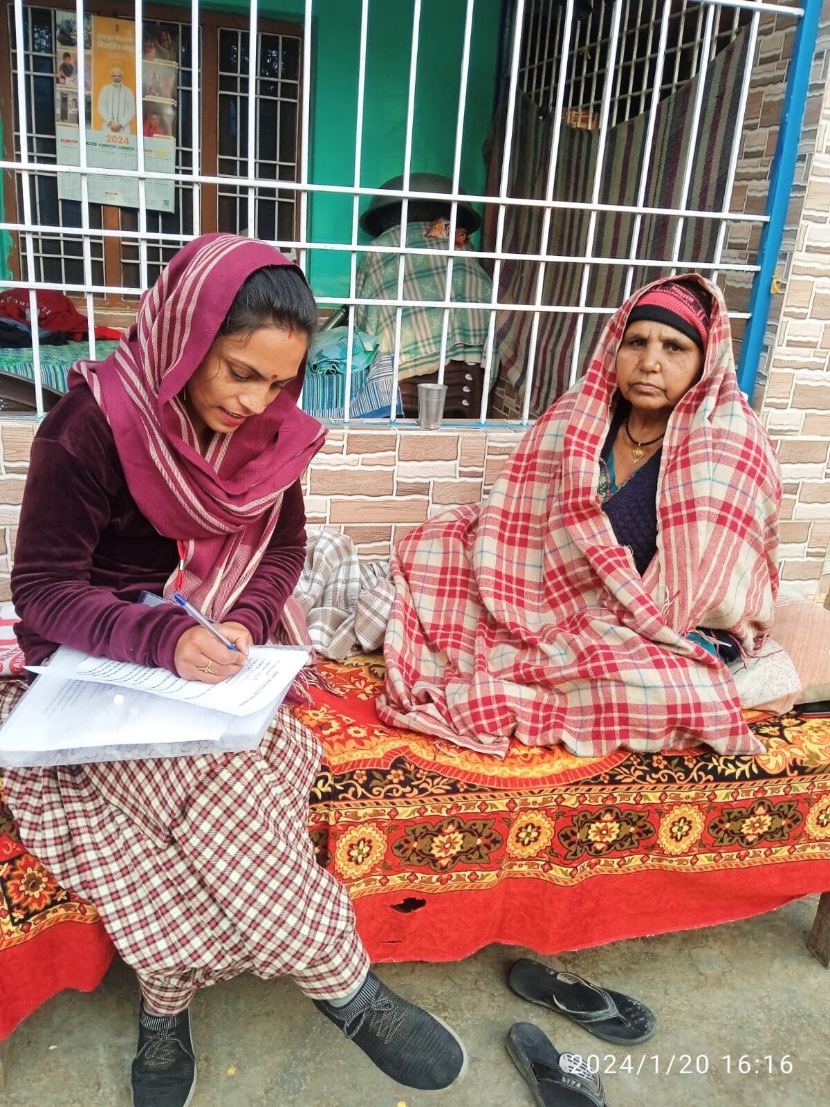
EDMRC-affiliated CRP / Aapda Mitra cadre conducting community-tier vulnerability documentation for HVCA and panchayat-resilience planning.
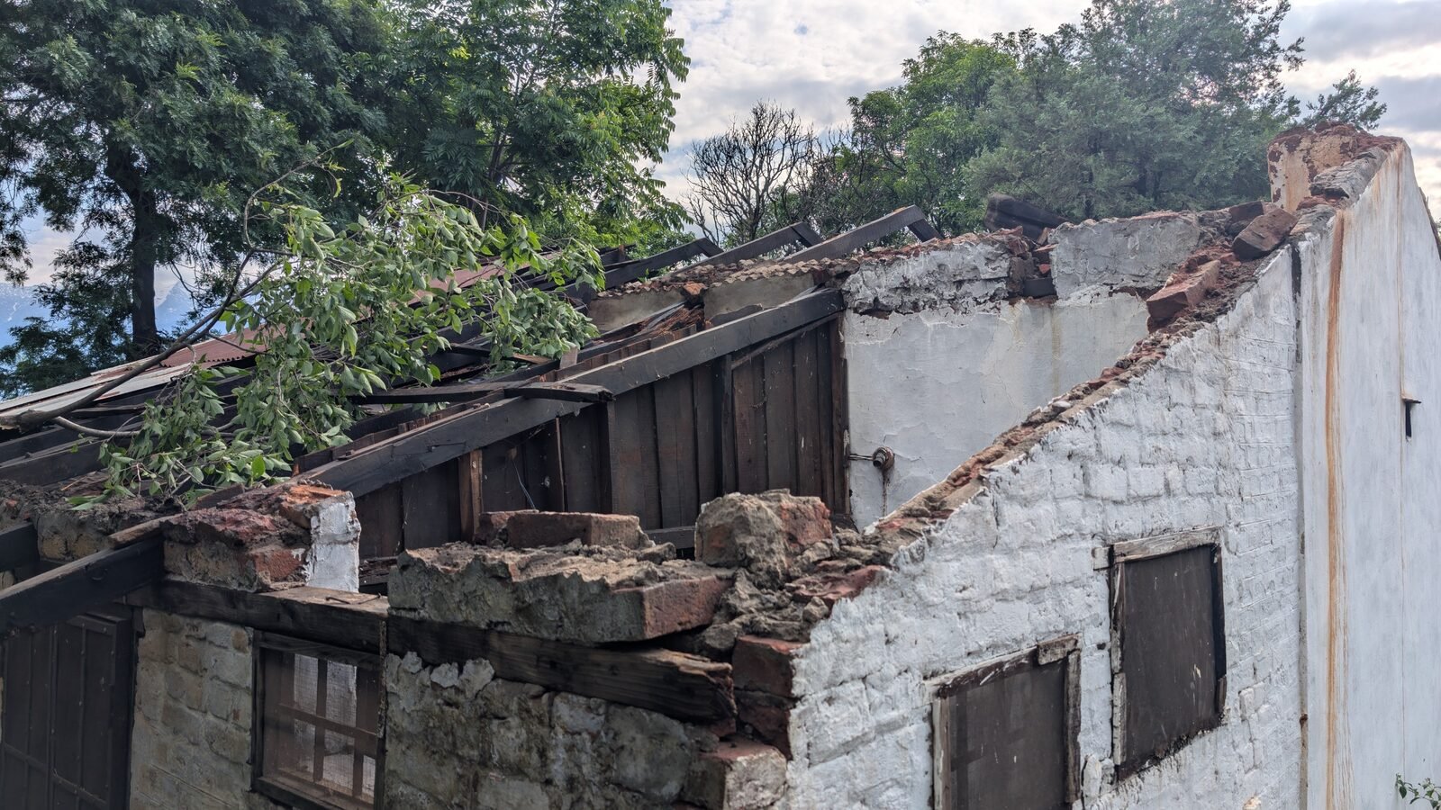
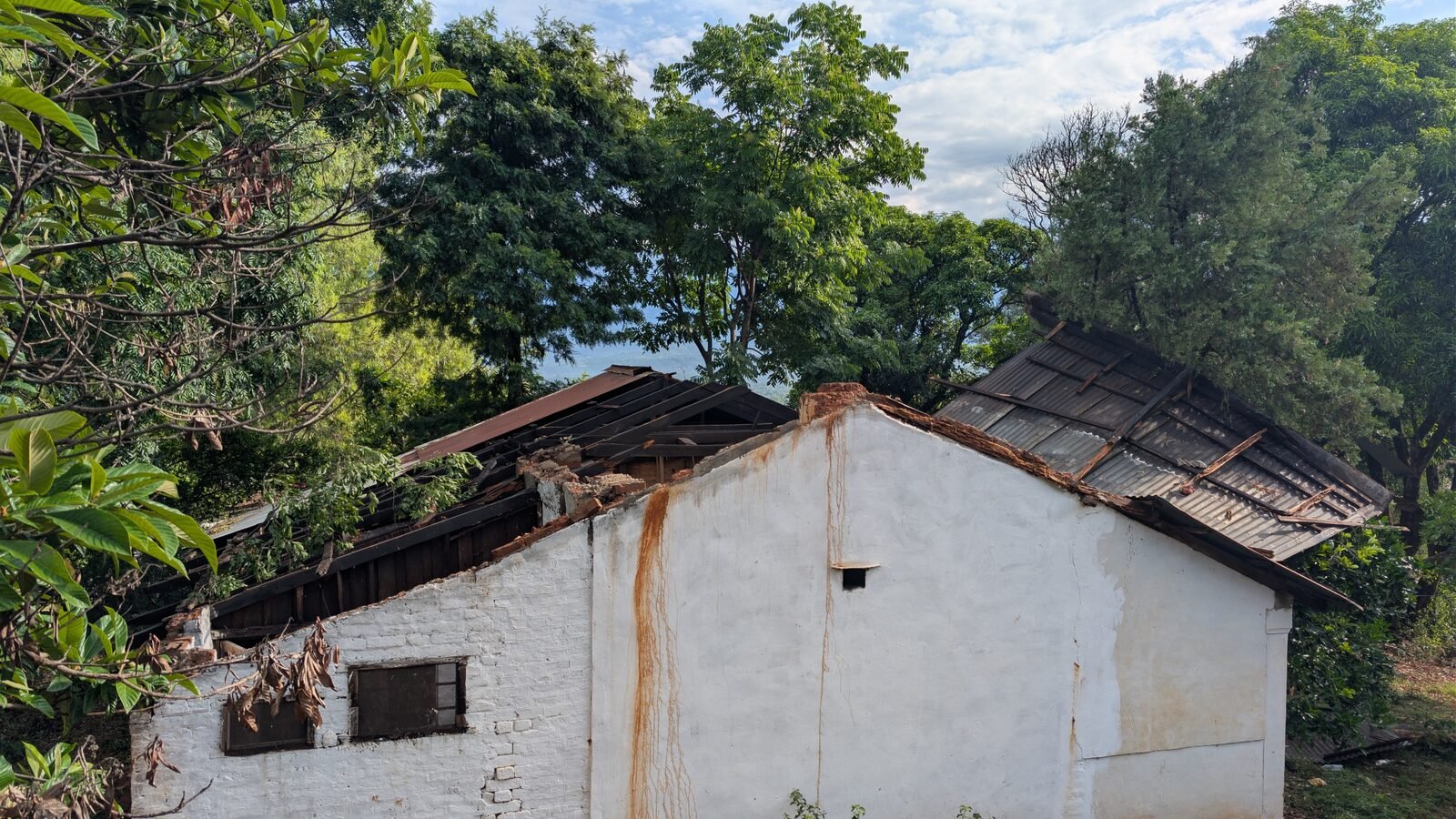
Detail of differential failure in traditional masonry — gable collapse, mortar degradation, exposed timber roof structure. The kind of failure mode catalogued in Rapid Visual Screening.
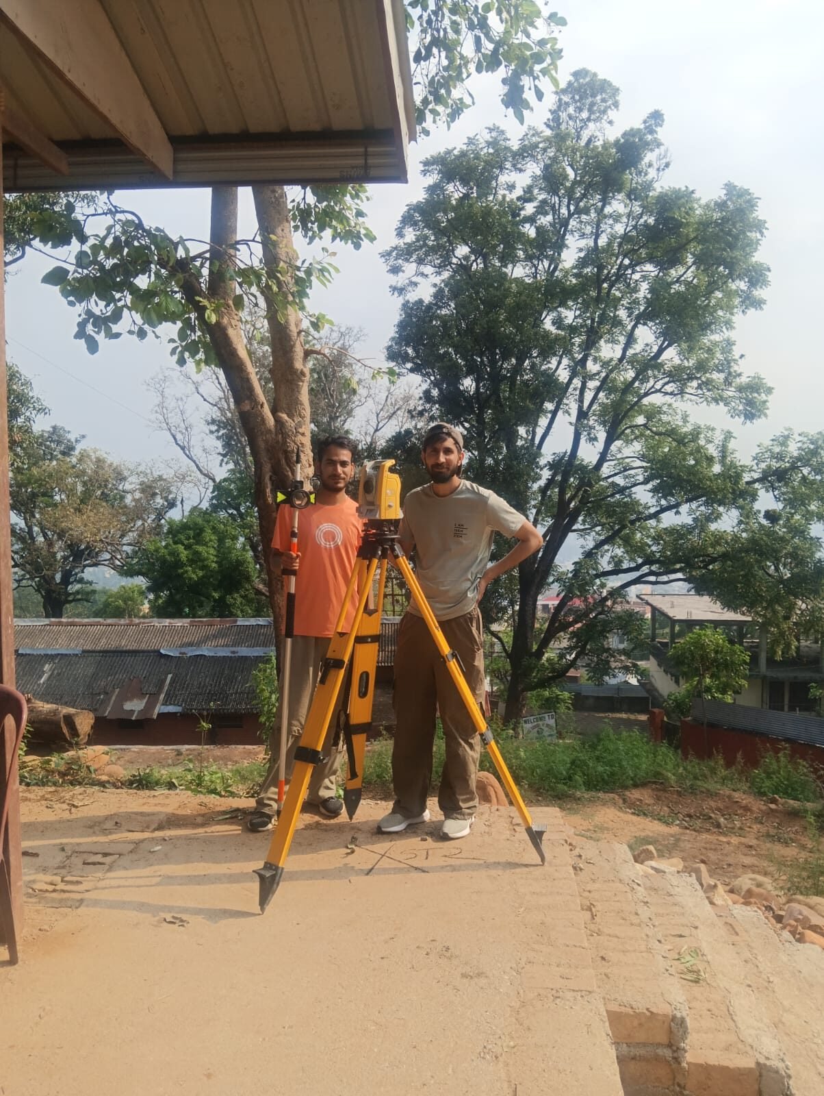
Pankaj Kumar (HimNIRMANAC Programme Lead) and field team with the total station survey rig, Mission Hill, Kangra. Used for high-precision footprint, retrofit scoping and damage-volume work.